

Ocean information behind the Sydney to Hobart

How IMOS data powers an optimised race strategy. As crews prepare to launch into one of the world’s most challenging ocean races, a group of oceanographers are also at work to help competitors optimise their route. IMOS provides data that delivers crucial oceanographic insights, including information about currents along the race route. Drawing on a […]
How our seabed mapping is boosting knowledge of Australia’s incredible marine estate

A collaborative effort by CSIRO and Geoscience Australia is delivering high-resolution seabed data to illuminate our ocean estate and make incredible discoveries. Australia has the third largest ocean territory on the planet, measuring 13.8 million square kilometres, including the Australian Antarctic Territory. Australia’s diverse oceans, seas and waterways form an integral part of our lifestyle, […]
AuScope in Antarctica: unlocking climate-response secrets hidden beneath the ice

Antarctica holds clues about how our planet is responding to climate change, and what that means for our future. AuScope is helping Australian researchers uncover critical new knowledge, by building and deploying polar-rated instrument sets that can withstand Antarctic extremes, drilling deep beneath the ice to retrieve ancient sediments, and developing software for modelling how […]
Better connecting people who power Australia’s innovation

A new national platform, ARDC Research Link Australia (RLA), is helping connect researchers, industry and government by making expertise and collaboration information easier to find and use. A recent pilot project with RLA shows how verified, accessible insights into Australian researchers’ capability can drive partnerships, innovation and productivity across the nation. Connecting People, Capability and […]
Supercharging Australian climate science: Australia’s Earth system model gets revamped for a clearer view of our future and past climate.

In short: Australia’s climate simulator (ACCESS-NRI) upgraded the ACCESS Earth system model to make it easier to use, ensuring reliable results and tailoring the code to the researcher needs. This sophisticated model provides a virtual laboratory for exploring Earth’s complex systems and has been widely used by the Australian climate research community, contributing to our understanding […]
Including land ice in the ACCESS Earth System Model: a community-led model selection approach

In short: ACCESS-NRI has adopted the Ice-sheet and Sea-level System Model (ISSM) as its support Ice Sheet model after an open and rigorous community-led selection process. What’s next?ACCESS-NRI will implement ISSM configurations of Antarctica and Greenland, with the ultimate goal to couple ISSM into ACCESS in order to improve decadal- to centennial-scale projections of global […]
Supporting Australia’s food security and agriculture industry

Over 90% of fruit, vegetables, meat, milk, and eggs sold in Australia are domestically produced, and over half of Australia’s agricultural produce is exported. As an important contributor to the Australian economy, the gross value of Australia’s agricultural food production is forecast at $79 billion for 2023-24, and our agricultural exports are forecast at $65 […]
Connecting the Community: the ACCESS-Hive User Hub

The ACCESS-Hive is an open-source collaborative portal developed by and for the community of users and developers of the ACCESS models. The ACCESS-Hive team l-r: Claire Carouge, Aidan Heerdegen, Romain Beucher, Heidi Nettelbeck and Roger Edberg. This portal includes access to all documentation relevant to the wider ACCESS community, as well as a platform for […]
A true partnership to improve position, navigation and timing services in Australia
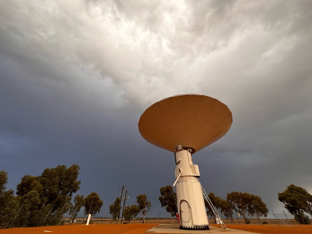
What do precision agriculture, weather predictions and synchronising financial transactions all have in common? They rely on geodesy, the science of measuring the Earth that enables all Positioning, Navigation and Timing (PNT) applications that are used in everyday life. This exact science underpins the global geospatial economy, which has a value of at least US$1 […]
Uncovering history: confirming the resting place of MV Blythe Star

Linking Australians to their heritage CSIRO research vessel (RV) Investigator, part of the Marine National Facility (MNF), offers a highly flexible platform that can accommodate multiple research projects on a single voyage. In providing this unique service, the MNF is helping to uncover our maritime heritage alongside other crucial research, such as mapping the seafloor […]
Shared Vocabularies Create Oceans of Opportunities

Research vocabularies are helping researchers aggregate data from a wide range of sources and disciplines to find evidence-based solutions to big societal challenges such as climate change. In 2021, an analysis of sea temperature data collected from the Southern Ocean over 25 years revealed disturbing evidence that the potential for Antarctic ice-sheet melting has been […]
Delivering Data to Improve Reporting on Australia’s Environment

Australia’s national research infrastructures are working together to streamline access to integrated data for State of the Environment reporting and other environmental assessments. The collaborative project is ensuring easy, open access to comparable, time-series datasets for key measures of the state of Australia’s environment and biodiversity. Every five years, the Australian Government delivers the State […]
AuScope underpins Julimar polymetallic minerals discovery

In November 2021, Chalice Mining Limited released a maiden resource statement for the Julimar polymetallic mineral deposit on Wadjuk Country in Western Australia. This is an exciting milestone for Chalice on the path to delivering palladium, nickel, copper and platinum for clean energy technologies. Equally impressive is the decades-long backstory to the Julimar discovery, which […]
Southern Ocean Time Series providing important data for ocean observations globally

Deployed and retrieved by the Marine National Facility (MNF) on behalf of Integrated Marine Observing System (IMOS), the Southern Ocean Time Series Observatory provides high temporal resolution observations in sub-Antarctic waters. Observations are broad and include measurements of physical, chemical and biogeochemical parameters from multiple deep water moorings in the sub-Antarctic Zone southwest of Tasmania. […]