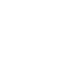
A true partnership to improve position, navigation and timing services in Australia
What do precision agriculture, weather predictions and synchronising financial transactions all have in common? They rely on geodesy, the science of measuring the Earth that enables all Positioning, Navigation and Timing (PNT) applications that are used in everyday life. This exact science underpins the global geospatial economy, which has a value of at least US$1 […]
How data linkage can improve the health of older people

Older people, despite bearing the burden of chronic disease and being more likely to take prescription drugs older people are under-represented in clinical trials. Studying older people When pharmaceutical companies do clinical trials, people over the age of 70 are often excluded. It’s partly ageism, says Professor Leon Flicker, a geriatric medicine specialist at The University of Western Australia. […]
Piloting the Australian Environmental Health (AusEnHealth) Strategic Planning Digital Twin

This ambitious one-year pilot project aims to understand the landscape of Australian environmental health data collection at both state and national levels. Rising temperatures, more extreme weather, and increasing carbon dioxide levels impact on water and food supply, degrade living conditions, increase social inequities, change vector ecology, increase air pollution and allergens, and impact on […]
From planets to pandemics: translating science in challenging times

After years of building NCRIS enabled software to address geodynamics problems, researcher and AuScoper from The University of Melbourne, Rohan Byrne, found an opportunity to turn his Everest code to help model COVID-19 mobility data during Melbourne’s 2020 and 2021 lockdown periods. Here, Rohan shares his story. JC — Rohan, please tell us what you […]
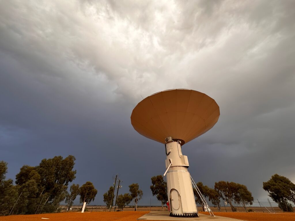
How Australia’s national research infrastructure is responding to COVID-19
Australia’s National Research Infrastructure (NRI) swiftly redeployed to support national and international COVID-19 research. Some examples are listed below. Australian Centre for Disease Preparedness (ACDP), Bioplatforms Australia (BPA), Microscopy Australia and Therapautic Innovation Australia (TIA) were involved in the University of Queensland vaccine program. Australian Plant Phenomics Facility (APPF) is supporting research into plant-based vaccines. Astronomy Australia […]
Improving Environmental Decision Making with Research Platforms
Over 7,000 users based at 400 different institutions in 35 countries have accessed ARDC-supported digital research platforms for ecological modelling to inform environmental research and decision making. Australia’s Environment Is in a State of Decline In a 2020 independent review of Australia’s environmental legislation, the Environment Protection and Biodiversity Conservation Act 1999, Prof Graeme Samuel […]
The risk of ‘Mr Fluffy’ insulation

When Australian National University epidemiologist Associate Professor Rosemary Korda first started holding public forums for Canberra residents affected by ‘Mr Fluffy’ insulation, people were very distressed. “There was quite a bit of anger in the room, and pretty upset people,” she remembers. “There were definitely people who were very concerned about future health effects of the asbestos insulation, particularly […]
State of The Environment Report – providing an evidence base
The national State of the Environment (SoE) report provides authoritative information on the natural environment that sustains our economy and wellbeing. It provides the Australian Government and other decision-makers with an assessment of how effectively the Australian environment is being managed and the key national environmental issues. These five-year assessments must be based on trustworthy […]
Global weather prediction: Australia’s contribution to the global Argo array
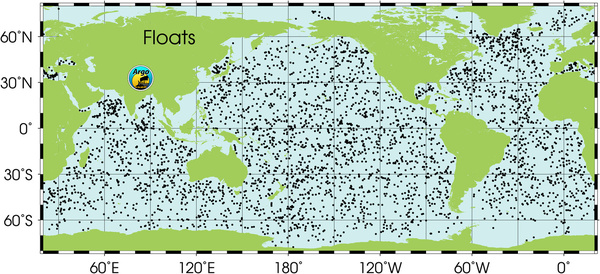
Australia’s Integrated Marine Observing System (IMOS) coordinates Australia’s contribution of approximately 10% of the global Argo array. Used internationally and by the Royal Australian Navy to predict ocean conditions, Argo data is critical to weather prediction globally. Argo data helps scientists understand large-scale ocean temperature and salinity structures, interactions between the ocean and atmosphere, and […]
Accelerating research into our towns, cities and communities
AURIN (Australian Urban Research Infrastructure Network) provides support to Australian researchers, planners, and policy makers to inform evidence-based decision making. The eresearch facility enables critical decision making for Australia’s future growth, sustainability and urban planning. AURIN provides a range of online tools and services to support spatio-statistical analysis and data visualisation. Known as Australia’s single […]